

Jonny sharing his local knowledge
We’ve written a lot about landmarks in the past, but never from the perspective of being at sea. So we were excited to join Jonny and Tony recently for a trip along the coast from Hallsands as part of the ‘Guardians of the Reef‘ project. Our aim was to document some of the names of the ‘marks’ that local fishermen have used for hundreds of years to navigate the seabed, which if not documented will soon be lost.

Tony on his boat
Fishermen have been using these ‘marks’ for generations; looking back towards the land and lining up visible landmarks to locate specific points on the seabed where crabs or fish can be found. This was vital when deciding where to place your pots or strong of pots, and enabled them to retrieve them on another day. Of course this is just one aspect of the knowledge that fishermen needed, they also required an in depth knowledge of the tides, seabed, weather and seasons. This knowledge, along with a compass and a clock (if you were lucky) meant that fishermen got to know the seabed intimately.
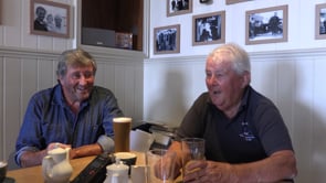
We had a fantastic time travelling along the beautiful stretch of coastline towards Prawle Point and filmed the lovely Jonny sharing with us some of the many names he had learnt from other local fishermen. Much of this knowledge had come from Winkie Steer, who we later joined in the pub along with Graham Lynn, to learn more about landmarks and how they were used. We have decided to archive the entire recording from the boat trip as it’s all really valuable, and have also made this short film with the Beesands boys-
The ‘Guardians of the Reef’ Project is delivered in partnership with the South Devon and Channel Shellfishermen Association and is made possible with thanks to funding from the Heritage Lottery Fund.